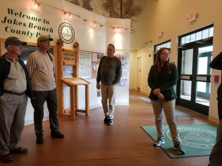
We’ve been so lucky with the weather throughout this Master Naturalist course. The trip to Cattus Island Park in Toms River, NJ was a clear, sunny spring day. Our guides were Brian, Nicole and Emily.
Brian began by giving a brief tutorial on how to us binoculars. It sounds like a needless exercise, but beginners often lose their target and struggle to focus them perfectly. It turns out that most of the time, one of your eyes is stronger than the other. You can adjust the focus of each eye independently, so customize your view to work with your eyesight capability. I never knew that!
Brian advised us to look at something approximately 20′ away without the binoculars. Cover up your right eye, keeping both eyes open. Use the main focus wheel to focus this left eye view. Then cover your other eye and keep both eyes open. Use the diopter (smaller wheel on the right side of the binoculars with a + and – sign) to focus this eye.
If you wear eye glasses, the eye cups should be up. If you don’t wear glasses, the eye cups should be down… this way the binoculars are a consistent distance away from your face, with or without eyeglasses.
When trying to find birds with your binoculars, you can see very far away, but you have a very small field of vision. You’ll have greater success in viewing your target if you look at the bird with your eyes and then bring up your binoculars in front of your eyes. If you don’t lose sight of the bird, you are less likely to have to search to find them with the binoculars.
If you are interested in finding out more about the birds that pass through and live in the pine barrens, invest in a field guide. Beginners should get one for Eastern birds. I just ordered this one from National Geographic today!
His recommendation is to take the time to look carefully at the bird and makes observations about it while it is there. Then, when it flies away, look it up in the field guide. If you spot a bird and then dig through the book immediately, it may fly away before you get a chance to look at it closely enough to notice the details you need to know to identify it.
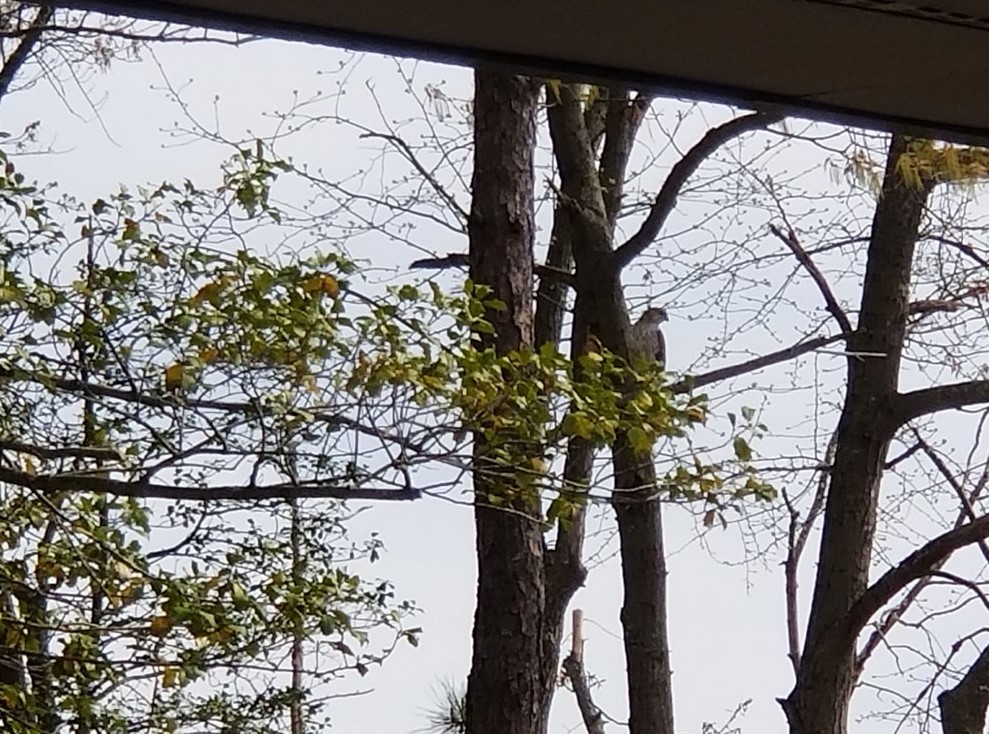
Close to the nature center, there is an area set up with bird houses and feeders and plants that attract local birds to frequent and congregate there. As we watched them, they all startled and left, just before a Cooper’s hawk swooped in. A Cooper’s hawk is an accipiter and it has a long, striped tail. They are forest hawks that catch and eat other birds. The best place to see hawks in NJ is Cape May in the fall.
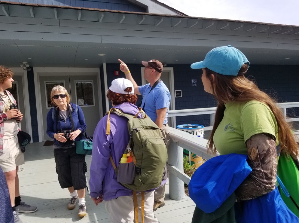
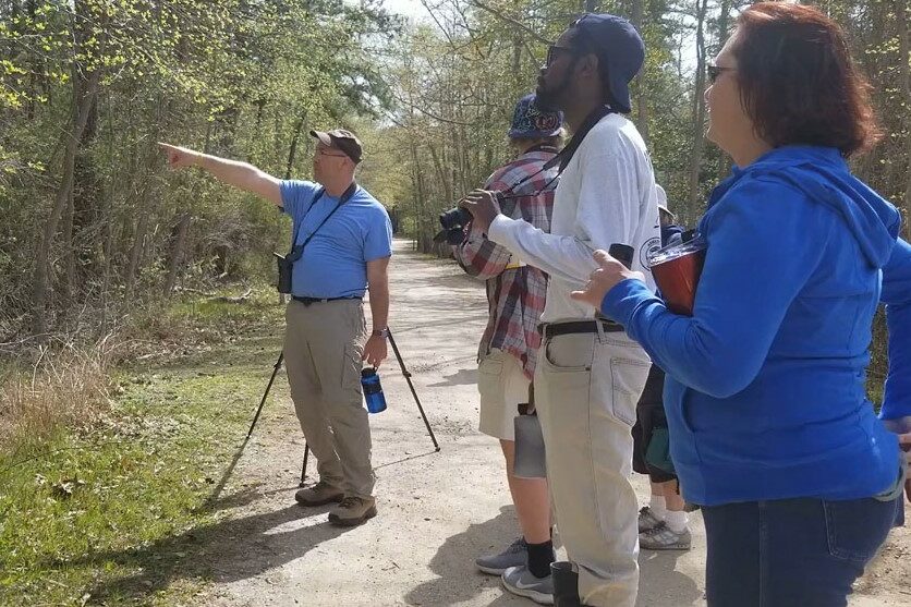
Brian took us for a bird walk along the trail to the beach and salt marsh. He set up a spotting scope to show a few birds to those of us who didn’t have binoculars on the trail. He pointed out the man-made Osprey nests set out in the Marsh. Ospreys are fish hawks that return to New Jersey around St. Patrick’s day. They mate for life, but he’s not certain if the reason is nest fidelity or mate fidelity.
Ospreys were endangered in NJ because of the use of DDT as a common pesticide. The effects of the chemical are cumulative and as smaller animals were eaten by larger ones, the chemical built up inside the tissues. The Ospreys were affected and the shells of their eggs got very thin. They became permeable by bacteria and the adult birds began to crush the shells of their own eggs when they flew back to their nests. In turn, the population plummeted. Once the use of DDT was banned, and fertilized eggs were brought up from Maryland to supplement the local compromised eggs, the Ospreys began to recover.
To help the struggling species, people have been building nests for them. Naturally, they would select large trees… but they add to the nests every year and they eventually kill the tree. The man-made nests are tall poles with a platform at the top. A short distance away, there is a smaller pole. The adults will hunt and feed themselves at the small pole away from the nest… then they bring the rest to the larger nest to feed their young.
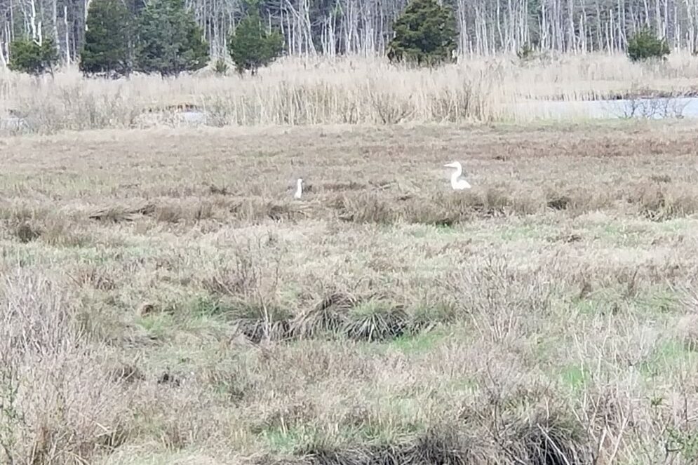
There were wading birds walking through the salt marsh. They walk through the water and catch and eat fish. The Great Egret has a long, yellow bill and dark yellow legs. They were hunted and killed for their fancy breeding plume feathers to be used to make hats. The little blue heron has white feathers in it’s first year. Those first feathers molt and new, blue colored feathers grow in.
Contrary to what I previously believed, nests are not bird homes. They are nurseries to lay eggs and raise their young. Birds migrate through this area on their way north just as the oak trees are blooming. Small insects like to buzz about the oak flowers and the warblers like to eat the bugs. 30 species of warblers migrate through New Jersey, many of them nest further north near the Catskills.
As we walked the trail through Cattus we saw red winged black birds (anker-eeeee!) The mails are bright and colorful. The physical differences in plumage from males to females is called sexual dimorphism and is frequently seen in song birds. Birds sing songs for a reason! Males sing to mark territory, to scare away other males and to attract mates.
As we walked, Brian and GraceAnne told us about the history of Cattus Island. The land was owned by the Cattus family and they built a large farmhouse as a summer vacation home. In the 1970s, the heirs wanted to sell the property to developers but the national wetlands laws decreed that the lands could not be developed to the extent that would make it economically profitable. The county later bought the protected property.
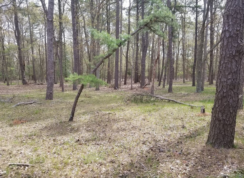
We noticed that on one side of the trail, the forest had thicket and brambles and shrubbery, but on the other side there was very little understory at all. Though this may seem like a healthy forest because it makes it easy for humans to explore, the understory layers are important for animal habitat and biodiversity. The bare side of the trail is due to deer browsing and it’s a big problem in New Jersey woods.
Jared, another plant enthusiast in the class, noticed native huckleberries on the side of the trail. He was able to identify the plant without fruit because of the resin on the leaves that reflect the light and make them sparkle!
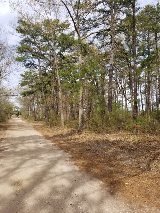
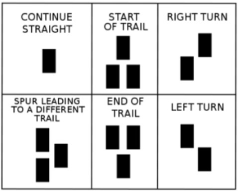
As we arrived at the beach, and Brian prepared to leave our group, he told us about his favorite trail in the park. The orange trail winds through the maritime forest, starting at the beach, looping around for a half mile and coming back to the beach again. He showed us what the trail markers mean (something I had never realized before and happened to be consistent in any state and county park).
What is Siening and How Do You Do It?
We took a short break to eat at the picnic area and then GraceAnne told us about siening and showed us how to do it. A few of the students put on waders and brought the nets out into the bay to see what they could catch. They put the little animals into plastic trays so everyone could see. They caught silver sides fish, mummy chug, shore shrimp and a few lion’s mane jelly fish. We talked about how sea lettuce shades out eel grass, which is important habitat that shelters juvenile fish species in the bay. The population explosion of sea nettle jellyfish and the prolific growth of sea lettuce is the result of eutrification, high nutrient load run off that infiltrates the bay.


After the first round of siening, Josh and Jared and I decided to step away from the others (as we were not dressed to tromp through the water) and we took a walk around the orange trail that Brian had recommended. As we walked we noticed thistles growing along the trail and loads of highbush blueberries.
I mentioned that I planned to do my final presentation for the class on the edible plants we had seen on our trips, so we began talking about them. Persimmon, service berry, beach plum and cranberry at Double Trouble. Prickly pear at FREC and Wells Mills. Huckleberry and blueberry here at Cattus Island… and that’s not even counting the edible weeds like dandelion and purple dead nettle we would see at island beach the next week. I would have plenty to talk about for 10 minutes! They will have to through rotten fruit at me to get me to shut up! haha.
salt marsh ecology and research
We got back to the group as they were finishing up the seining exercise. Emily, a field tech from Barnegat Bay Partnership told us about the activities available for volunteers to help out with researchers from BBP. She told us about salt marsh ecology and the research performed at the marsh and the effects of marsh practices.
Mosquito ditches are hand dug… straight lines across the marsh and out into the bay that keep the water moving and prevent standing water for mosquitoes to breed. Open Marsh Water Management practices are theoretically beneficial but rarely carried out in a positive way. Channels are dug to connect pools in the marsh, but the material dug out is usually just scattered carelessly about which smothers grasses and disturbs plants. To combat erosion, the height of the marsh shelf is raised by spraying dredged material on top, but is often sprayed too thick so that spartina smooth cord grass that makes up the marsh struggle to grow through the new top layer.
Barnegat Bay Partnership does salt marsh research for Mid Atlantic Coastal Management. They are given random points by the EPA to go and do rapid assessments which include looking at areal footage and taking on the ground measurements of the marsh. They check for grass stem height, light (at the top of the stem and at the soil level) which tells them how dense the vegetation is. They check the fauna including the mussels on the marsh platform and marsh edge. The edges of the marsh tend to have more problems than the platform. They measure accretion (sediment) and erosion (removal) of the marsh.
To volunteer to help with research, you can participate in “Paddle for the Edge”. Paddle for the Edge is a data collection effort driven by volunteer kayakers, canoeists, and stand-up paddle boarders. “The BBP’s survey includes various shoreline features and key biotic indicators, which help to assess conditions and identify what processes are impacting the bay’s shorelines. The indicators cover a range of processes, such as recreational use, shellfish growth, water quality, erosion and accretion, built structures, and plant and animal composition. The data collected will help us monitor these critical bay shorelines and assist planners and resource managers in many ways.”
The wetlands are incredibly important to our ecology. The marsh is acts like a filter to help clean the water from the bay. It is the most productive ecosystem outside of the rainforest. We can help protect the valuable marsh edge with man made reefs and structures that interrupt the waves and wakes and collect and stabilize sediment so that it doesn’t wash away. Mussels protect the edge from wave action like a natural concrete barrier. These are living shorelines!
Related Posts